Navigation

Entries in remote sensing (4)

Wednesday
Dec032014

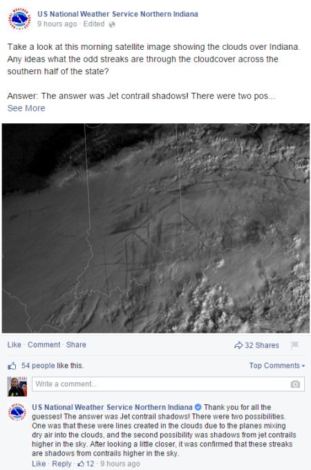
He could have told the NWS in Indiana that posting that was a BIG mistake 

Dan Satterfield of the AGU Blogosphere has an entertaining entry for the anxiety surrounding contrails.

Read it here: http://blogs.agu.org/wildwildscience/2014/12/03/told-nws-indiana-posting-big-mistake/

NWS INDY

Tuesday
Aug052014

The Visual Microphone: Passive Recovery of Sound from Video

This is a link to a very cool study about recoverable information present in ambient acoustic vibrations. Well worth the watch!


Thursday
Feb142013

An asteroid fly-by to be streamed live to the internet. Impressed?

Monday
Jan072013

Awesome! 2013 IGS calendar features LiDAR dataset of East Fork of the White River

The folks at the Indiana Geological Survey are always pushing forward. This year's calendar shows the relict and modern-day stream channels of the East Fork of the White River just south of the confluence of the Driftwood and Flatwood Rivers near Columbus, Indiana. Cartographers at the Indiana Geological Survey analyzed elevation data using geographic information system software, or GIS, to create the image. The data were acquired using an airborne laser with a technology called LiDAR—light detection and ranging. At the Indiana Geological Survey, LiDAR elevation and corresponding intensity data are a crucial component of our geologic mapping efforts. 

 see it at: http://igs.indiana.edu/bookstore/details.cfm?ItemID=2160&Pub_Num=CAL2013